National Weather Service Local Forecast for Star Valley Ranch
Updated: Mon Aug 11  1:29 pm MT

Tonight... Mostly clear, with a low around 49. North northwest
wind 5 to 9 mph becoming light and variable.

Tuesday... Sunny, with a high near 88. Calm wind becoming west
northwest 5 to 9 mph in the afternoon.

Tuesday Night... Mostly clear, with a low around 53. West wind
5 to 8 mph becoming south southeast in the evening.

Wednesday... A 20 percent chance of showers and thunderstorms
after noon.  Sunny, with a high near 92. Light and variable wind
becoming west 9 to 14 mph in the afternoon. Winds could gust as high
as 22 mph.

Wednesday Night... A 10 percent chance of showers and
thunderstorms before 9pm.  Partly cloudy, with a low around 54. West
wind 6 to 14 mph becoming south southeast after midnight. Winds could
gust as high as 22 mph.

Thursday... A 20 percent chance of showers and thunderstorms
after noon.  Mostly sunny, with a high near 88. South southeast wind 5
to 11 mph becoming west in the afternoon. Winds could gust as high as
21 mph.

Thursday Night... A slight chance of showers and thunderstorms.
 Partly cloudy, with a low around 52. West wind 6 to 8 mph becoming
south southeast after midnight.  Chance of precipitation is 20%.

Friday... A 30 percent chance of showers and thunderstorms
after noon.  Mostly sunny, with a high near 86.

Friday Night... A 10 percent chance of showers and
thunderstorms before midnight.  Partly cloudy, with a low around 50.

Saturday... A 20 percent chance of showers and thunderstorms
after noon.  Sunny, with a high near 86.

Saturday Night... A slight chance of showers and thunderstorms.
 Partly cloudy, with a low around 50.

Sunday... A slight chance of showers and thunderstorms.  Sunny,
with a high near 87.

Sunday Night... Mostly clear, with a low around 49.

Monday... Sunny, with a high near 88.
789
FXUS65 KRIW 111930
AFDRIW

Area Forecast Discussion
National Weather Service Riverton WY
130 PM MDT Mon Aug 11 2025

.KEY MESSAGES...

- A bit warmer today with isolated showers and thunderstorms(10%
  chances) in Johnson and Natrona Counties.

- Rather hot Tuesday through Thursday, with elevated to critical
  fire weather conditions possible on Wednesday (60% chance) and
  Thursday (40% chance).

- Coverage of thunderstorms increases Wednesday and likely peaks
  on Friday, with most likely chances across southern WY in
  monsoonal flow.

&&

.UPDATE...
Issued at 128 PM MDT Mon Aug 11 2025

Relatively quiet weather conditions continue today and are expected
again tomorrow as the ridge continues to build. With the building
ridge, temperatures are already notably warmer today and will be
warmer yet tomorrow, maxing out on Wednesday. Showers are beginning
to develop along the northern Bighorns, but as expected, these have
been fairly weak and limited in coverage. 10% chances for showers
will continue across mainly along the Bighorns in Johnson County
through the afternoon.

As mentioned in the discussion below, the return of critical fire
weather conditions across southwest WY on Wednesday is still looking
likely (60% chance). Outside of the typical Rock Springs to Casper
wind corridor, it is worth noting the EFI/SoT is keying in on
western WY (Jackson and Star Valleys, and the western WY mountains)
for wind gusts greater than climatology Wednesday afternoon. This,
coupled with fuels that are designated as near record dry levels,
could be worth watching for fire concerns come Wednesday. Current
forecasts do indicate near critical RHs across the valleys, but RHs
will struggle to reach critical levels for higher elevations and
even across the valleys Wednesday afternoon. It is also worth noting
that RH forecasts have been trending drier over the past few model
runs, so if this trend continues, the hoisting of fire highlights
may be warranted. Thursday, RHs look to improve with increasing
monsoonal flow, so fire weather concerns are looking lesser,
despite gusty southwest winds and continued hot and mostly dry
conditions.

&&

.DISCUSSION...
Issued at 231 AM MDT Mon Aug 11 2025

All in all, things look fairly quiet today across the area. There
is one exception, and that is across Johnson and northern Natrona
Counties where there could be a few showers and thunderstorms
this afternoon where some moisture is lingering. With higher heights
today, coverage looks sparse though (less than a 1 in 5
chance). Elsewhere, we removed the POPs. We can't rule out a
stray shower, but most models are mainly dry. The NAM Nest has
some showers, but it's middle name may as well be overdone
orographics as precipitable waters are under a half an inch in
most of these locations and there is no real trigger other than
some weak diurnal upslope flow. Anything that forms may just be
cumulus and maybe some virga. There will be a gusty breeze at
times today in northern Wyoming, the result of a gradient
between a trough moving eastward over the northern Plains states
and high pressure over the West Coast, The areas will the wind
will be the most moist though, so no fire weather highlights
will be needed today. Temperatures should average close to
normal.

Temperatures will increase somewhat as flow begins to turn
southwesterly on Tuesday. Many places East of the Divide will see
highs in the 90s on this day. As for convection, a weak shortwave
brushing by to the north may bring a few showers and storms.
However, southwest flow will also bring in drier air, with
precipitable water values dropping about 10 to 20 percent when
compared to Monday. So, we have some in the northern mountains but
coverage remains isolated (less than a 1 in 4 chance).

Wednesday looks like the warmest day at this point as the ridge
flattens and southwest flow really increases. A southwesterly breeze
will increase and bring highs well in the 90s East of the Divide,
with a few locations flirting with 100. Mid and high level moisture
will also increase on this day, especially across the west. So, POps
are higher this day. However, the surface remains rather dry and
precipitable waters are at best near normal. As a result, any storms
would be of the high based variety and have more wind than rain.
With the low humidity, elevated to critical fire weather will become
a concern, especially across the Rock Springs to Casper wind
corridor.

Thunderstorm coverage should increase on Thursday as a trough and
cold front approaches from the west. More cloud cover should
also bring somewhat cooler temperatures, especially West of the
Divide. Hot temperatures are expected to continue East of the
Divide though. Precipitable water levels do rise on this day but
only back to near climatological averages. As a result, there
will be a more widespread chance of showers and storms but the
chance in any given location remains low (generally less than 1
out of 3). In addition, humidity may remain low enough for some
elevated to critical fire weather, especially in the windier
locations.

Friday may be the most active day as precipitable waters peak on
this day. Temperatures should fall back close to normal for all
locations as well. Following that, most guidance shows a
gradually fall in coverage as drier air moves into the area as
ridging builds northward across the Rockies for the weekend and
early next week. Temperatures through this period should average
near to somewhat above average. &&

&&

.AVIATION /18Z TAFS THROUGH 18Z TUESDAY/...
Issued at 1125 AM MDT Mon Aug 11 2025

VFR conditions are expected at all TAF sites throughout the
forecast period, with a very small (10%) chance of MVFR
conditions due to MVFR ceilings at sites east of the divide
overnight. North-northwest flow is over western and central WY
today, with moisture moving from south-central MT into north-
central WY toward the SSE. With mostly clear skies west of the
divide and some breezy northwest wind, skies will be partly to
mostly cloudy east of the divide with breezy north-northeast
winds at times. KCOD/KWRL/KCPR will see some gusty north winds
during the middle and late afternoon and perhaps into the early
evening hours, but only 15-20 kts are expected. Models are
indicating some light showers over the northern Absarokas and
the Bighorns late this afternoon and into the evening, with
only a 5% chance of showers getting into KCOD and KCPR.

Overnight should see mostly clear west of the divide,
with mostly cloudy east of the divide as the weak shortwave
trough moves to the SE. Winds will be light overnight as the
mean flow shifts more the the west on Tuesday. Clouds are
expected to be heavier over the northern part of the state, with
some weak showers possible along the MT/WY border, which may
impact KCOD around 13/00Z. The southwest WY TAF sites will see
gusty west winds in the afternoon with mostly clear skies.

Please see the Aviation Weather Center and/or CWSU ZDV and ZLC for
the latest information on icing and turbulence forecasts.

&&

.RIW WATCHES/WARNINGS/ADVISORIES...
None.

&&

$$

UPDATE...Hensley
DISCUSSION...Hattings
AVIATION...McDonald
-----------------
|
Visible Satellite Loop

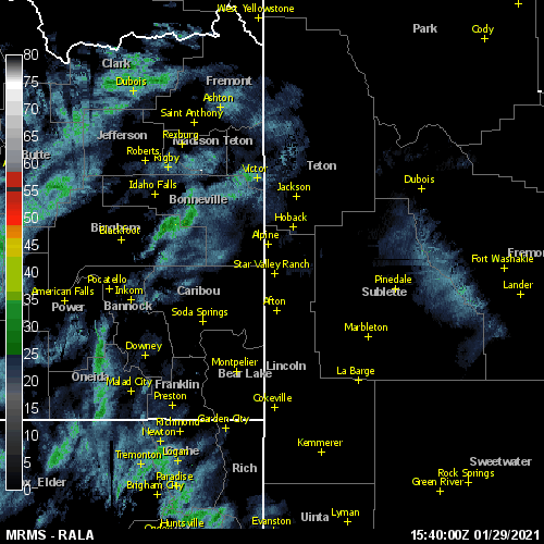
Regional Radar Loop
24-hour Precipitation Estimate
Current Surface Pattern

Current 500mb Pattern

Recent Salt Lake City Sounding

Latest Surface Chart
|